Plate Tectonics of Denali National Park and the Building of the Mountain

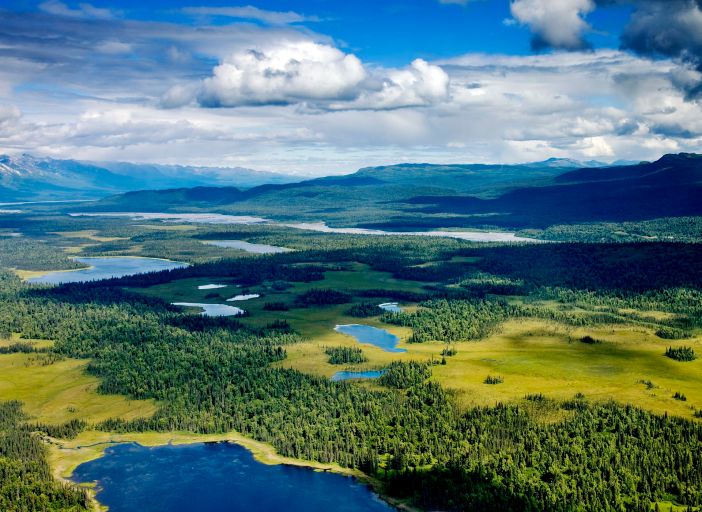
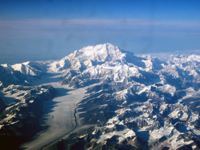
Plate tectonics fundamentally explains how the landscape of Denali National Park was built and why the mountain of Denali rises to 20,310 feet (US.NPS-1). Convection currents in the Earth’s molten mantle move the plates of the crust.


21
Figure 1: A cross section of the Earth, showing convection in the mantle and the moving crustal plates that result (US.NPS-1).

The denser oceanic Pacific plate constantly moves 2-3 inches per year towards the North American Plate of Alaska and goes beneath, through subduction (US.NPS-2).

22
Figure 2: A 3-D visual of the earthquake activity near Denali National Park from 1898 to 2004. This shows the location of the subducting Pacific Plate beneath the park and also the Denali Fault (US.NPS-2).

This collision creates mountain uplift of the Alaska Range. Additionally, the plate convergence created the Denali transform fault, with the land to the South of the fault moving West at 1 cm per year. The fault is curved just North of the mountain of Denali. This contributes to further mountain building, as lateral movement along the fault makes land pile up (US.NPS-1).

23
Figure 3: This map shows the location of the Denali Fault and its curved shape. Note how close the fault is to the mountain of Denali and the location of the 2002 earthquake that is discussed below (NASA).

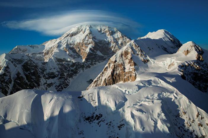
The rock composition of the mountain also contributes to Denali’s height. While not a volcano, volcanic processes have developed Denali. Magma that cooled beneath the surface, forming a granite igneous batholith, makes up most of the mountain. Being less dense than adjacent rocks, over time this granite rose to the surface as Denali. The mountain continues to gain height at 0.5 millimeters per year and outpaces weathering and erosion, because of the resistant granite (US.NPS-1).

24
Figure 4: This map shows the historic locations of major earthquakes in Alaska (USGS).

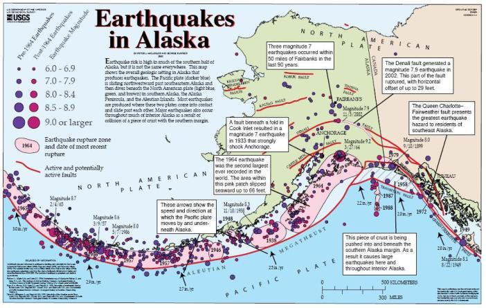
Running right by Denali, the Denali Fault triggers around 600 earthquakes a year within the park that are at least a magnitude 1. On November 3, 2002, the largest earthquake recorded in the interior of Alaska, at 7.9 magnitude, shook the park from its epicenter along the Denali Fault, 30 miles away (US.NPS-3). It caused offsets and cracks in the ground over 20 feet wide in some locations. Scientists study the fault because of its similarities to the San Andreas Fault, which could produce more destruction to dense human population (NASA).

25
Figure 5: A fault crack resulting from the November 3, 2002 earthquake (NASA).
OLYMPUS DIGITAL CAMERA
Figure 6: A 23 foot offset of Tok highway resulting from the November 3, 2002 earthquake (USGS).

Thus, the complex interaction of plate subduction, faults, and volcanic processes continues to produce the landscape of Denali, as well as shape the lives of the people living in the area.

References

Dr. Casey D. Allen, Associate Professor, Department of Geography & Environmental Sciences University of Colorado Denver: Geographic concepts and understanding were taken from lectures on building Earth’s landscapes in his Introduction to Physical Geography class.

United States. National Park Service. “The Alaska Range and Denali: Geology and Orogeny (U.S. National Park Service).” National Parks Service. U.S. Department of the Interior, n.d. Web. 25 Oct. 2016. https://www.nps.gov/articles/denali.htm, Article-1

United States. National Park Service. “Earthquake and Seismic Monitoring in Denali (U.S. National Park Service).” National Parks Service. U.S. Department of the Interior, n.d. Web. 25 Oct. 2016. https://www.nps.gov/articles/aps-v5-i1-c6.htm, Article-2

United States. National Park Service. “Earthquakes & Tectonics.” National Parks Service. U.S. Department of the Interior, n.d. Web. 25 Oct. 2016. https://www.nps.gov/dena/learn/nature/earthquakes.htm, Article-3

NASA. “Denali’s Fault.” NASA: Earth Observatory. NASA, 13 Nov. 2003. Web. 25 Oct. 2016. http://earthobservatory.nasa.gov/Features/denali/

Figure References

Figure 1: United States National Park Service Article-1 (US.NPS-1) and The United States Geological Survey

Figure 2: United States National Park Service Article-2 (US.NPS-2)

Figure 3: NASA

Figure 4: By USGS [Public domain], via Wikimedia Commons,  https://upload.wikimedia.org/wikipedia/commons/8/8d/Alaska_earthquakes.jpg

Figure 5: NASA and USGS

Figure 6: By U.S. Geological Survey [Public domain], via Wikimedia Commons,  https://upload.wikimedia.org/wikipedia/commons/e/e8/Tok_Cutoff_USGS.jpg

Header Image: By Nic McPhee from Morris, MN, USA (Road to special places) [CC BY-SA 2.0 (http://creativecommons.org/licenses/by-sa/2.0)%5D, via Wikimedia Commons,  https://commons.wikimedia.org/wiki/File%3AMount_McKinley_Alaska.jpg


Climatic, Atmospheric, and Temperature Conditions of Denali

Denali National Park’s location on the earth affects its climatic and atmospheric conditions and how these interact with human experience.

map
Figure 1: Map of the Location of Denali National Park in Southern Interior Alaska (Wikipedia).

Denali’s location at approximately 63˚ North latitude results in wide differences in solar radiation between the summer and winter (Wikipedia). In addition, its relatively interior location within Alaska, as a of part North America, causes continentality, or the lack of significant ocean moderation on temperature. These two factors result in large average temperature differences between the mild summers and bitterly cold winters for the park as a whole (Table 1).

untitled
Table 1: Average Temperatures and Precipitation for Denali National Park by Month (Wikipedia).


low
Figure 2: Lower Elevations in the Park Showing a Mild Summer Climate (Highsmith, Carol).

Also influencing climate and weather in the park is the massive difference between the lowest elevation of 233 feet and the mountain of Denali, at 20,310 feet (Smith). This elevation disparity creates wide differences in temperatures based on adiabatic cooling, with temperatures decreasing with increasing altitude. Furthermore, the size and elevation prominence from its surroundings of the Denali massif causes orographic lifting of air, which works in conjunction with the lifting condensation level to produce clouds that often cover the top of the mountain, even when the sky is clear in other parts of the park.

summit
Figure 3: Clouds Forming Over the Summit of Denali as the Result of Orographic Lifting (Huey, Aaron).


The many climbers who attempt to summit Denali, must be especially aware of these atmospheric and weather processes to survive. Some example temperatures, based on altitudes, can be calculated assuming the following: a 70˚F temperature at the lowest point in the park, a constant dry adiabatic lapse rate of -5.5˚F per 1000 feet gain, a wet rate of -2.5˚F per 1000 feet, and a lifting condensation level of 15,000 feet, where the dry rate switches to the wet rate and clouds form. The temperature at the 7,200 foot base camp would be approximately 32˚F and at the summit -24˚F (Smith).


camp
Figure 4: Climbers Camping at 17,200 feet on Denali (Wiesmueller, James).

In fact, weather stations and thermometers have recorded low temperatures of between −75.5 °F and −100 °F on the glacier and snow covered mountain (Wikipedia).

glacier.jpg
Figure 5: Arial Photograph in September Showing Year-Round Snow and Glaciers on and Surrounding Denali (ArcticHokie).

References

Dr. Casey D. Allen, Associate Professor, Department of Geography & Environmental Sciences University of Colorado Denver: Geographic concepts and details such as solar radiation, continentality, orographic lifting, lifting condensation level, and adiabatic lapse rates come from lectures on climate basics and processes in his Introduction to Physical Geography class.

Wikipedia. “Denali National Park and Preserve.” Wikipedia. Wikimedia Foundation, 29 Sept. 2016. Web. 30 Sept. 2016. https://en.wikipedia.org/wiki/Denali_National_Park_and_Preserve

Wikipedia. “Denali” Wikipedia. Wikimedia Foundation, 29 Sept. 2016. Web. 30 Sept. 2016. https://en.wikipedia.org/wiki/Denali

Smith, Darren. “Denali National Park – Monthly Temperatures, What Weather Should You Expect at Denali National Park?” About.com Travel. N.p., 25 Aug. 2016. Web. 30 Sept. 2016. http://usparks.about.com/od/denali/fl/Denali-National-Park-Monthly-Temperatures.htm

Figure and Table References

Figure 1: Wikipedia. “Denali National Park and Preserve.”

Table 1: Wikipedia. “Denali National Park and Preserve.”

Figure 2: By Carol M. Highsmith (1946–) – Library of Congress, Prints & Photographs Division, LC-DIG-highsm-04272 (original digital file), uncompressed archival TIFF version (53 MiB), converted to JPEG (quality level 88) with the GIMP 2.6.7, Public Domain, https://commons.wikimedia.org/w/index.php?curid=9588389

Figure 3: Huey, Aaron. King of Summits. Digital image. National Geographic. N.p., 19 July 2016. Web. 30 Sept. 2016.                        http://www.nationalgeographic.com/travel/national-parks/denali-photos/

Figure 4: By James Wiesmueller, then lead forecaster for the National Weather Service (www.accessnoaa.noaa.gov/jul1701/summit.html) [Public domain], via Wikimedia Commons,                     https://commons.wikimedia.org/wiki/File%3ADenali_high_camp.jpg

Figure 5: By ArcticHokie (Own work) [CC BY-SA 3.0 (http://creativecommons.org/licenses/by-sa/3.0)%5D, via Wikimedia Commons, https://commons.wikimedia.org/wiki/File%3ADenali3.jpg

Header Image: By Nic McPhee from Morris, MN, USA (Road to special places) [CC BY-SA 2.0 (http://creativecommons.org/licenses/by-sa/2.0)%5D, via Wikimedia Commons,  https://commons.wikimedia.org/wiki/File%3AMount_McKinley_Alaska.jpg


Introduction

This blog will examine some of the interesting aspects of the physical geography of Denali National Park. The park is located in the southern part of the interior of Alaska and contains the tallest mountain in North America, also called Denali (formerly named Mount McKinley).

I am an Economics Major and a lifelong Colorado resident. Denali National Park interests me, as I love spending time in unspoiled nature. One of my favorite activities is hiking and I am drawn to the tallest mountains of Colorado and around the world. Having recently visited the park, I can attest to its intriguing physical landscapes, abundant wildlife, local cultural significance, and immense beauty.

I hope your interest in Denali will be sparked by this blog and that you will gain some understanding of the features and the natural processes at work there and appreciate their significance. However, without visiting in person, it is impossible to truly understand the scale of the park and its full majesty. As such, I recommend traveling to Denali National Park and hope this blog with encourage you to do so, because I believe it is one of the most significant natural locations in the world.

Header Image Source:

https://commons.wikimedia.org/wiki/File%3AMount_McKinley_Alaska.jpg

By Nic McPhee from Morris, MN, USA (Road to special places) [CC BY-SA 2.0 (http://creativecommons.org/licenses/by-sa/2.0)%5D, via Wikimedia Commons